Winter Wonderland Ahead: Major Snowstorm to Hit I-95 Corridor This Weekend!
December 13, 2025
As winter continues to take hold of the Northeast and Mid-Atlantic, a major snowstorm is set to blanket the I-95 corridor this weekend.
Starting Saturday night and extending into Sunday morning, meteorologists are forecasting a fast-moving clipper system that promises to deliver significant snow accumulations across major metropolitan areas such as Washington D.C., Baltimore, Philadelphia, and New York City.
With predictions varying from light flurries to plowable snow, residents along the I-95 corridor are advised to prepare for challenging road conditions and to take necessary precautions as we embrace this winter wonderland ahead.
Key Takeaways
- A major snowstorm is expected to affect the I-95 corridor this weekend, impacting major cities from D.C. to NYC.
- Snow accumulation will vary significantly, with some areas potentially receiving up to 8 inches.
- Residents are advised to prepare for significant weather changes and potential travel disruptions due to snow.
Overview of the Upcoming Snowstorm
As we brace for the brunt of winter, an upcoming snowstorm is poised to sweep across the Mid-Atlantic and Northeast regions, especially along the I-95 corridor.
This significant weather event is set to commence on Saturday night and transition into Sunday morning, leaving both communities and commuters on high alert.
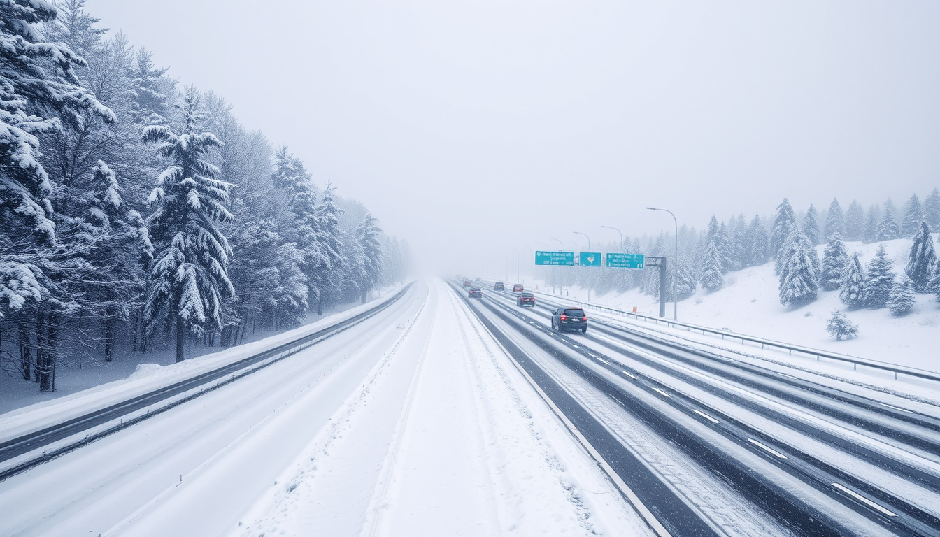
Meteorologists have identified a fast-moving clipper storm that will bring varying levels of snowfall across major metropolitan areas, including Washington D.C., Baltimore, Philadelphia, and New York City.
In terms of snow accumulation, forecasts suggest that different zones will see different impacts: Zone 1 is expected to receive 1 inch or less of snow, while Zone 2 may see between 1 to 3 inches.
Zone 3 could experience up to 6 inches of snowfall, creating potential travel disruptions and calling for snow preparation by residents.
Moreover, Zones 4 and 5 are likely to begin with rain before transitioning into snow, leading to lesser accumulations.
However, certain predictions are more alarming, particularly for areas near I-95, which could see upwards of 8 inches of snow—especially effective around Baltimore where conditions are ideal for enhancing snowfall.
This impending winter storm follows a period of notably cold temperatures, and while the snow could create picturesque scenes, drive safely!
After the storm, models indicate a warm-up, possibly diminishing snow concerns for the following week.
Meteorologists are stressing the importance of preparedness, suggesting extensive attention to local updates and advising on snow clearing strategies.
With winter in full swing, this robust storm presents not only potential beauty but also serious risks, making it crucial for residents to remain attentive and proactive.
Impact and Preparation Tips for Residents
Residents in the affected areas should actively prepare for this winter storm to mitigate risks associated with heavy snowfall.
Here are some essential preparation tips.
First, ensure that your car is winter-ready: check antifreeze levels, switch to winter tires if you haven't already, and stock your vehicle with emergency supplies, including blankets, non-perishable snacks, and a flashlight.
It's also wise to keep a snow shovel and ice melt materials on hand to clear your driveway and walkways, preventing accumulation that could pose safety hazards.
Additionally, consider creating an emergency kit for your home, equipped with necessary medications, batteries, and enough food and water to last at least three days in case of power outages.
Stay informed by monitoring weather updates from reliable sources and heed any travel advisories; if possible, plan to stay home during the height of the storm to avoid potentially dangerous conditions on the roads.
By taking these proactive steps, you can safeguard your household and reduce stress as the snow begins to fall.